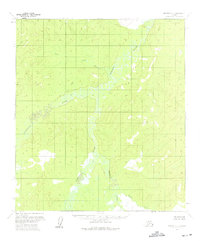
1954 Map of Medfra D-4
USGS Topo · Published 1975About this map
The Nowitna River snakes through this interior landscape, defining a complex system of oxbow lakes and wetlands as it flowed in the mid-1950s. This survey, compiled from 1953 and 1955 aerial photography, reveals a wilderness largely untouched by permanent settlement or infrastructure. The Susulatna River enters from the west, contributing to a drainage pattern of high-relief ridges and saturated lowlands. Smaller tributaries like Pilot Creek and Sunrise Creek drain the upland terrain, while Meadow Bridge Creek winds through the southern reaches. The map reflects a moment in Alaskan history when the interior was being methodically documented by the Geological Survey, providing an essential record of the natural waterways and unmarked land lines before any significant modern encroachment or development in the Yukon-Koyukuk region.
Find a feature on this map
5 named features on this map. Tap any name to fly to it.
Don’t see what you’re looking for? This feature index may not catch every label — zoom into the map to look around manually.
Map Details
Editions of this 1954 Medfra D-4 Map
2 editions found
Other maps of this area

1950 · Medfra
USGS Topo · 1:250,000

1951 · Ruby
USGS Topo · 1:250,000

1952 · Ruby A-3
USGS Topo · 1:63,360

1952 · Ruby A-4
USGS Topo · 1:63,360

1952 · Ruby A-5
USGS Topo · 1:63,360

1952 · Ruby
USGS Topo · 1:250,000

1953 · Medfra C-4
USGS Topo · 1:63,360

1954 · Medfra C-5
USGS Topo · 1:63,360

1954 · Medfra D-5
USGS Topo · 1:63,360
1954 · Medfra D-3
USGS Topo · 1:63,360