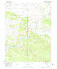
1968 Map of Ruby Canyon
USGS Topo · Published 1972About this map
The Colorado River carves a deep path through this 1968 landscape, defining the geographic character of Ruby Canyon and Horsethief Canyon. The winding waterway is flanked by notable alluvial flats including Ruby Bottom, Crow Bottom, and Moore Bottom, while the distinctive Black Rocks formations mark the river's edge. This desert terrain is further shaped by the Denver and Rio Grande Western railroad, which follows the river's contours through the canyon.
Find a feature on this map
24 named features on this map. Tap any name to fly to it.
Don’t see what you’re looking for? This feature index may not catch every label — zoom into the map to look around manually.
Map Details
Editions of this 1968 Ruby Canyon Map
3 editions found
Other maps of this area

1885 · East Tavaputs
USGS Topo · 1:250,000

1956 · Westwater 4 SE
USGS Topo · 1:24,000

1956 · Grand Junction
USGS Topo · 1:250,000

1959 · Grand Junction
USGS Topo · 1:250,000

1960 · Grand Junction
USGS Topo · 1:250,000

1962 · Grand Junction
USGS Topo · 1:250,000

1962 · Mack
USGS Topo · 1:24,000
1962 · Battleship Rock
USGS Topo · 1:24,000

1964 · Grand Junction
USGS Topo · 1:250,000

1965 · Grand Junction
USGS Topo · 1:250,000