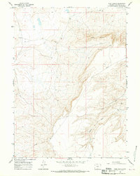
1966 Map of Ruby Knolls
USGS Topo · Published 1970About this map
Ruby Knolls and the surrounding high desert of Sweetwater County characterize this 1960s topographic survey. The landscape is defined by its drainage patterns, notably the winding paths of Creston Draw and Buck Draw as they cut through the arid terrain. While the area lacks dense settlement, the map records the infrastructure of mid-century resource extraction and transit, including a prominent Pipeline and scattered markers like a Drill Hole and several Well sites. Transportation is limited to functional desert routes, specifically the Riner Cutoff Road, which provided essential access across this portion of the Red Desert. The sparse distribution of named features and survey benchmarks like BM 6724 reflects a working landscape where water sources and geological markers were the primary points of orientation for travelers and land managers alike.
Find a feature on this map
11 named features on this map. Tap any name to fly to it.
Don’t see what you’re looking for? This feature index may not catch every label — zoom into the map to look around manually.
Map Details
Editions of this 1966 Ruby Knolls Map
2 editions found
Other maps of this area

1954 · Rawlins
USGS Topo · 1:250,000

1958 · Rawlins
USGS Topo · 1:250,000

1960 · Hansen Lake NE
USGS Topo · 1:24,000

1960 · Larsen Knoll
USGS Topo · 1:24,000

1960 · Hansen Lake
USGS Topo · 1:24,000

1962 · Rawlins
USGS Topo · 1:250,000

1966 · Jawbone Ranch
USGS Topo · 1:24,000

1966 · Creston Junction
USGS Topo · 1:24,000

1966 · Wamsutter
USGS Topo · 1:24,000

1966 · Monument Lake
USGS Topo · 1:24,000