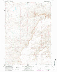
1966 Map of Ruby Knolls
USGS Topo · Published 1981About this map
Ruby Knolls rises as a prominent landmark in this high desert landscape of Sweetwater County, marking a terrain defined by ancient drainage patterns and modern industrial infrastructure. This 1966 survey, later updated with revisions from 1980, reveals a dry environment where significant geographic features like Buck Draw and Creston Draw cut through the arid plains. The presence of a prominent Pipeline and several scattered Drill Holes points to the region's mid-century role in resource extraction and energy development. The map meticulously documents the transition from the mid-1960s to the early 1980s, providing a precise record of how surveyors tracked the subtle topography of the Wyoming basin during a period of shifting land use and exploration.
Find a feature on this map
5 named features on this map. Tap any name to fly to it.
Don’t see what you’re looking for? This feature index may not catch every label — zoom into the map to look around manually.
Map Details
Editions of this 1966 Ruby Knolls Map
2 editions found
Other maps of this area

1954 · Rawlins
USGS Topo · 1:250,000

1958 · Rawlins
USGS Topo · 1:250,000

1960 · Hansen Lake NE
USGS Topo · 1:24,000

1960 · Larsen Knoll
USGS Topo · 1:24,000

1960 · Hansen Lake
USGS Topo · 1:24,000

1962 · Rawlins
USGS Topo · 1:250,000

1966 · Jawbone Ranch
USGS Topo · 1:24,000

1966 · Creston Junction
USGS Topo · 1:24,000

1966 · Wamsutter
USGS Topo · 1:24,000

1966 · Monument Lake
USGS Topo · 1:24,000