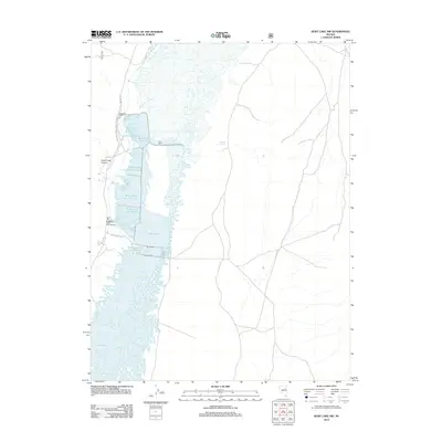
2012 Map of Ruby Lake NW
USGS Topo · Published 2012About this map
Ruby Lake dominates this high-desert basin, revealing a complex network of managed wetlands and infrastructure at the base of Cave Creek Canyon. The map details the systematic division of the marsh into managed habitats, including Ruby Lake Unit Ten, Ruby Lake Unit Fourteen, and Ruby Lake Unit Twenty-one. These areas are partitioned by a series of dikes, most notably the CCC Dike, which reflects historic conservation labor in the valley, along with the Short Dike and Brown Dike. Human activity in this remote Elko County landscape is primarily focused on resource management and historical habitation. The Gallagher State Fish Hatchery is a prominent landmark along the western edge, while the presence of the Bressman Cabin near the northern marsh units points to the area's grazing or sporting history. Localized water sources like Gardner Spring and the Y Pond sustain the ecosystem between the rugged canyon mouth and the valley floor.
Find a feature on this map
17 named features on this map. Tap any name to fly to it.
Don’t see what you’re looking for? This feature index may not catch every label — zoom into the map to look around manually.
Map Details
Editions of this 2012 Ruby Lake NW Map
This is the sole edition of this map. No revisions or reprints were ever made.
Other maps of this area

1934 · Jiggs
USGS Topo · 1:125,000

1937 · Jiggs
USGS Topo · 1:125,000

1955 · Elko
USGS Topo · 1:250,000

1958 · Elko
USGS Topo · 1:250,000

1959 · Jiggs
USGS Topo · 1:62,500

1959 · Sherman Mtn
USGS Topo · 1:62,500

1962 · Elko
USGS Topo · 1:250,000

1965 · Elko
USGS Topo · 1:250,000

1968 · Franklin Lake SE
USGS Topo · 1:24,000

1968 · Franklin Lake SW
USGS Topo · 1:24,000