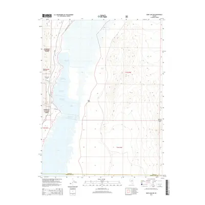
2015 Map of Ruby Lake NW
USGS Topo · Published 2015About this map
The Ruby Mountains dominate the western landscape of this Nevada basin, where the high peaks drop into the extensive wetlands of Ruby Lake. This 2015 survey details a complex system of managed waters including Ruby Lake Unit Ten, Ruby Lake Unit Twenty-one, and the Y Pond, illustrating the critical role of water management in the high desert. The small settlement of Ruby Valley sits on the edge of these marshes, linked to the mountains by the Cave Creek Canyon and the Cave Creek Trail. The map also captures the transition from the Humboldt National Forest in the west to the Maverick Springs Range in the east, highlighting landmarks like Gardner Spring and the Brown Dike that define the local geography at the border of Elko and White Pine counties.
Find a feature on this map
22 named features on this map. Tap any name to fly to it.
Don’t see what you’re looking for? This feature index may not catch every label — zoom into the map to look around manually.
Map Details
Editions of this 2015 Ruby Lake NW Map
This is the sole edition of this map. No revisions or reprints were ever made.
Other maps of this area

1934 · Jiggs
USGS Topo · 1:125,000

1937 · Jiggs
USGS Topo · 1:125,000

1955 · Elko
USGS Topo · 1:250,000

1958 · Elko
USGS Topo · 1:250,000

1959 · Jiggs
USGS Topo · 1:62,500

1959 · Sherman Mtn
USGS Topo · 1:62,500

1962 · Elko
USGS Topo · 1:250,000

1965 · Elko
USGS Topo · 1:250,000

1968 · Franklin Lake SE
USGS Topo · 1:24,000

1968 · Franklin Lake SW
USGS Topo · 1:24,000