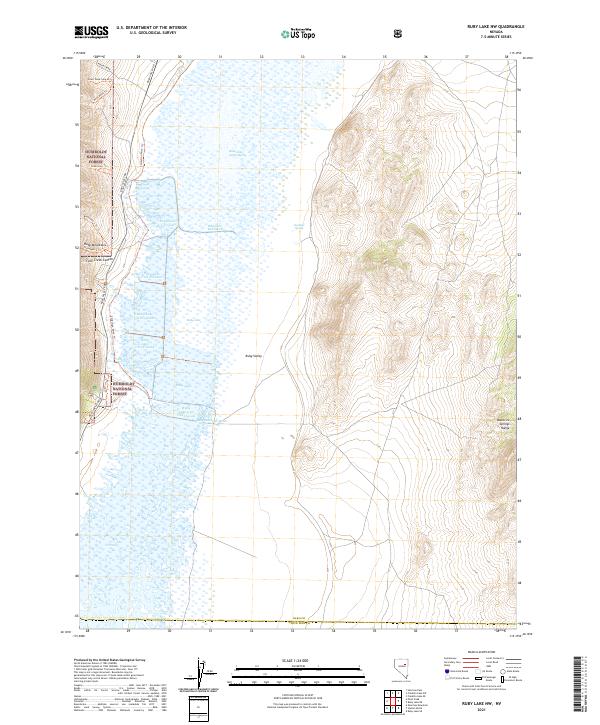
2021 Map of Ruby Lake NW
USGS Topo · Published 2021About this map
Ruby Lake National Wildlife Refuge dominates this section of the Great Basin, where the high peaks of the Ruby Mountains meet an expansive wetland system. The map documents a complex aquatic environment within the Ruby Valley, featuring numerous managed compartments such as Ruby Lake Unit Ten, Ruby Lake Unit Fourteen, and the Ruby Lake South Marsh. These marshes represent a critical desert oasis, fed by sources like Gardner Spring and organized by features like the Collection Ditch Trl.
Find a feature on this map
32 named features on this map. Tap any name to fly to it.
Don’t see what you’re looking for? This feature index may not catch every label — zoom into the map to look around manually.
Map Details
Editions of this 2021 Ruby Lake NW Map
This is the sole edition of this map. No revisions or reprints were ever made.
Other maps of this area

1934 · Jiggs
USGS Topo · 1:125,000

1937 · Jiggs
USGS Topo · 1:125,000

1955 · Elko
USGS Topo · 1:250,000

1958 · Elko
USGS Topo · 1:250,000

1959 · Jiggs
USGS Topo · 1:62,500

1959 · Sherman Mtn
USGS Topo · 1:62,500

1962 · Elko
USGS Topo · 1:250,000

1965 · Elko
USGS Topo · 1:250,000

1968 · Franklin Lake SE
USGS Topo · 1:24,000

1968 · Franklin Lake SW
USGS Topo · 1:24,000