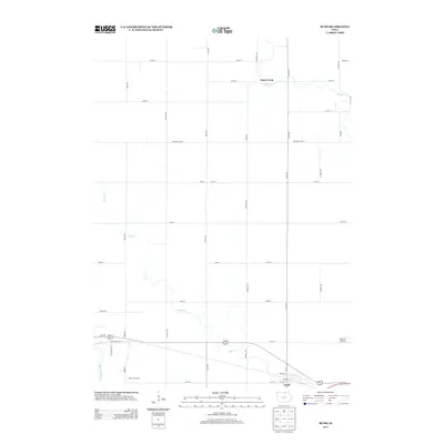
2013 Map of Rudd
USGS Topo · Published 2013About this map
Rudd anchors the southeastern corner of this Floyd County landscape, situated along a grid of streets including Depot St and Hampton St. The surrounding countryside is defined by the meandering courses of the Shell Rock River and Flood Cr, which cut through a traditional Midwestern section-line road network. To the west, Rock Grove City sits near the riverbanks, while the northern reaches are marked by the small settlement of Rock Creek and the eponymous Rock Cr. The map captures a moment in the early 21st century when local infrastructure like Folkerts Airport served the agricultural community. This area's geography is characterized by the transition from open fields to the riparian corridors of the river valleys, where roads like Rock Grove Dr and Cameo Rd navigate the more varied terrain near the water.
Find a feature on this map
35 named features on this map. Tap any name to fly to it.
Don’t see what you’re looking for? This feature index may not catch every label — zoom into the map to look around manually.
Map Details
Editions of this 2013 Rudd Map
This is the sole edition of this map. No revisions or reprints were ever made.
Other maps of this area

1954 · Mason City
USGS Topo · 1:250,000

1957 · Mason City
USGS Topo · 1:250,000

1958 · Mason City
USGS Topo · 1:250,000

1959 · Mason City
USGS Topo · 1:62,500

1959 · Nora Springs
USGS Topo · 1:24,000

1959 · Mason City SE
USGS Topo · 1:24,000

1971 · Rockford
USGS Topo · 1:24,000

1971 · Orchard
USGS Topo · 1:24,000

1971 · Rudd
USGS Topo · 1:24,000
1971 · Roseville
USGS Topo · 1:24,000