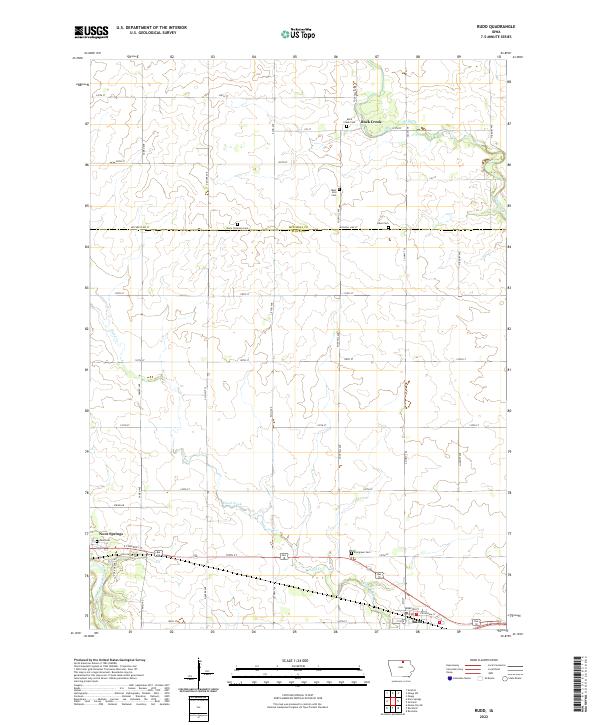
2022 Map of Rudd
USGS Topo · Published 2022About this map
The Shell Rock River snakes through the southwest corner of this landscape, anchoring the community of Nora Springs. Moving east, the terrain is defined by the winding paths of Flood Creek and Rock Creek, which drain a heavily gridded agricultural interior. The town of Rudd sits at a rail and road junction in the southeast, serving as a local hub for the surrounding Floyd County farmsteads.
Find a feature on this map
44 named features on this map. Tap any name to fly to it.
Don’t see what you’re looking for? This feature index may not catch every label — zoom into the map to look around manually.
Map Details
Editions of this 2022 Rudd Map
This is the sole edition of this map. No revisions or reprints were ever made.
Other maps of this area

1954 · Mason City
USGS Topo · 1:250,000

1957 · Mason City
USGS Topo · 1:250,000

1958 · Mason City
USGS Topo · 1:250,000

1959 · Mason City
USGS Topo · 1:62,500

1959 · Nora Springs
USGS Topo · 1:24,000

1959 · Mason City SE
USGS Topo · 1:24,000

1971 · Rockford
USGS Topo · 1:24,000

1971 · Orchard
USGS Topo · 1:24,000

1971 · Rudd
USGS Topo · 1:24,000
1971 · Roseville
USGS Topo · 1:24,000