
1960 Map of Rudolph
USGS Topo · Published 1961About this map
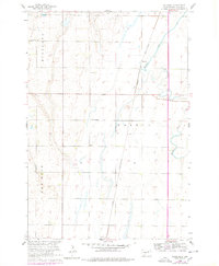
Chicago and North Western rail lines slice through this Brown County landscape, providing the primary industrial pulse for the small settlement at Rudolph. The terrain is characterized by the meandering path of Moccasin Creek, which winds through the eastern portion of the survey area. This 1960 field-checked map reveals a rural community structured around local education and service, as evidenced by the distribution of several country schools including St John Sch, Sunshine Sch, and Wright Sch.
Find a feature on this map
15 named features on this map. Tap any name to fly to it.
Don’t see what you’re looking for? This feature index may not catch every label — zoom into the map to look around manually.
Map Details
Editions of this 1960 Rudolph Map
2 editions found
Other maps of this area

1895 · Aberdeen
USGS Topo · 1:125,000

1899 · Northville
USGS Topo · 1:125,000

1953 · Warner
USGS Topo · 1:24,000

1954 · Mellette
USGS Topo · 1:24,000

1954 · Aberdeen
USGS Topo · 1:250,000

1956 · Aberdeen
USGS Topo · 1:250,000
1960 · Aberdeen East
USGS Topo · 1:24,000

1960 · Aberdeen West
USGS Topo · 1:24,000
1960 · Northville
USGS Topo · 1:24,000
1966 · Chelsea
USGS Topo · 1:24,000