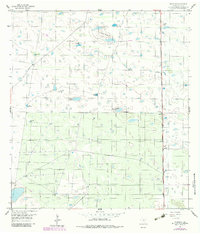
1956 Map of Rudolph
USGS Topo · Published 1984About this map
The Missouri Pacific railroad corridor defines the eastern edge of this coastal prairie landscape, anchoring the small settlement of Rudolph. In an area where surface water is scarce, the map reveals a critical network of subterranean resource extraction, marked by numerous family-named and localized water sources such as the Mota Verde Artesian Well, Noria Nueva Artesian Well, and the Conchita Artesian Well. These wells, along with features like La Badia de Pitoso, suggest a specialized ranching or agricultural infrastructure dependent on deep-tapped water.
Find a feature on this map
21 named features on this map. Tap any name to fly to it.
Don’t see what you’re looking for? This feature index may not catch every label — zoom into the map to look around manually.
Map Details
Editions of this 1956 Rudolph Map
2 editions found
Other maps of this area

1921 · Tarida Ranch
USGS Topo · 1:62,500

1922 · La Sal Vieja
USGS Topo · 1:62,500

1923 · Armstrong
USGS Topo · 1:62,500

1923 · Saltillo Ranch
USGS Topo · 1:62,500

1953 · Brownsville
USGS Topo · 1:250,000

1956 · Julian
USGS Topo · 1:24,000

1956 · Saltillo Well
USGS Topo · 1:24,000

1956 · Rudolph
USGS Topo · 1:24,000

1956 · Andrea Ranch
USGS Topo · 1:24,000

1956 · Rosita Lake
USGS Topo · 1:24,000