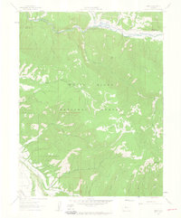
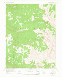
1961 Map of Ruedi
USGS Topo · Published 1963About this map
The Fryingpan River corridor and the settlement of Ruedi are central to this 1961 survey, which captures the region just before significant hydrological changes altered the valley floor. High-altitude landscape features like Ford Peak and the high basins of Kobey Park are detailed alongside a network of seasonal access routes, including a Jeep Trail through Red Canyon and various Pack Trails used for ranching and forest management.
Find a feature on this map
30 named features on this map. Tap any name to fly to it.
Don’t see what you’re looking for? This feature index may not catch every label — zoom into the map to look around manually.
Map Details
Editions of this 1961 Ruedi Map
5 editions found

Other maps of this area

1893 · Aspen
USGS Topo · 1:62,500

1895 · Aspen
USGS Topo · 1:62,500

1909 · Mount Jackson
USGS Topo · 1:125,000

1911 · Mount Jackson
USGS Topo · 1:125,000

1957 · Leadville
USGS Topo · 1:250,000

1959 · Leadville
USGS Topo · 1:250,000

1960 · Leadville
USGS Topo · 1:250,000

1960 · Highland Peak
USGS Topo · 1:24,000
1960 · Thimble Rock
USGS Topo · 1:24,000

1960 · Aspen
USGS Topo · 1:24,000