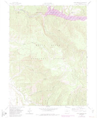
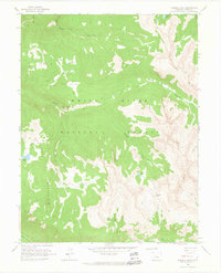
1961 Map of Ruedi Reservoir
USGS Topo · Published 1983About this map
Ruedi Reservoir dominates the northeastern corner of this terrain, where the Fryingpan River flows through the high country of the White River National Forest. Surveyed in the early 1960s with 1980s updates, the map documents a transition in water management and land use along the border of Eagle and Pitkin counties. The landscape is defined by its complex drainage network, including the headwaters of Woody Creek and Rocky Fork Creek, which cut deep through the surrounding peaks.
Find a feature on this map
34 named features on this map. Tap any name to fly to it.
Don’t see what you’re looking for? This feature index may not catch every label — zoom into the map to look around manually.
Map Details
Editions of this 1961 Ruedi Reservoir Map
5 editions found

Other maps of this area

1893 · Aspen
USGS Topo · 1:62,500

1895 · Aspen
USGS Topo · 1:62,500

1909 · Mount Jackson
USGS Topo · 1:125,000

1911 · Mount Jackson
USGS Topo · 1:125,000

1957 · Leadville
USGS Topo · 1:250,000

1959 · Leadville
USGS Topo · 1:250,000

1960 · Leadville
USGS Topo · 1:250,000

1960 · Highland Peak
USGS Topo · 1:24,000
1960 · Thimble Rock
USGS Topo · 1:24,000

1960 · Aspen
USGS Topo · 1:24,000