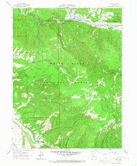
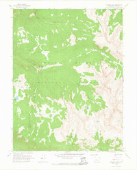
1961 Map of Ruedi
USGS Topo · Published 1967About this map
The Fryingpan River corridor serves as the primary axis of human activity in this 1961 survey, where the settlement of Ruedi sits along the northern edge. This area, located within the White River National Forest, is defined by a network of drainage systems such as Woody Creek and Rocky Fork Creek that cut through high-elevation terrain toward the river. The presence of a Cem near Ruedi and seasonal outposts like Cox Camp points to the long-standing ranching and forest-service history of the region.
Find a feature on this map
37 named features on this map. Tap any name to fly to it.
Don’t see what you’re looking for? This feature index may not catch every label — zoom into the map to look around manually.
Map Details
Editions of this 1961 Ruedi Map
5 editions found

Other maps of this area

1893 · Aspen
USGS Topo · 1:62,500

1895 · Aspen
USGS Topo · 1:62,500

1909 · Mount Jackson
USGS Topo · 1:125,000

1911 · Mount Jackson
USGS Topo · 1:125,000

1957 · Leadville
USGS Topo · 1:250,000

1959 · Leadville
USGS Topo · 1:250,000

1960 · Leadville
USGS Topo · 1:250,000

1960 · Highland Peak
USGS Topo · 1:24,000
1960 · Thimble Rock
USGS Topo · 1:24,000

1960 · Aspen
USGS Topo · 1:24,000