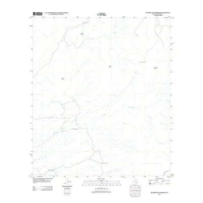
2012 Map of Ruidosa Hot Springs
USGS Topo · Published 2012About this map
Ruidosa Hot Springs and its surrounding desert highlands define this section of Presidio County, where the Chihuahuan Desert meets volcanic landforms. The landscape is marked by isolated water sources such as Red Tank and Perdis Tank, alongside the seasonal Hot Springs Cr. High peaks like Cleveland Peak, Cerro Chino, and Loma Blanca provide significant orientation points across the arid terrain. Working ranch life in this corner of West Texas is documented through Vizcaino Ranch and Benavides Ranch, with the Big Shanon Windmill serving as a vital mechanical landmark for water management. The road network is sparse, centered on the unpaved Hot Springs Rd and Pinto Canyon Rd, which navigate the elevation changes near Ojo Carrizo.
Find a feature on this map
17 named features on this map. Tap any name to fly to it.
Don’t see what you’re looking for? This feature index may not catch every label — zoom into the map to look around manually.
Map Details
Editions of this 2012 Ruidosa Hot Springs Map
This is the sole edition of this map. No revisions or reprints were ever made.
Other maps of this area

1895 · Marfa
USGS Topo · 1:125,000

1896 · Ruidosa
USGS Topo · 1:125,000

1896 · San Carlos
USGS Topo · 1:125,000

1896 · Shafter
USGS Topo · 1:125,000

1959 · Presidio
USGS Topo · 1:250,000

1959 · Marfa
USGS Topo · 1:250,000

1965 · Presidio
USGS Topo · 1:250,000

1965 · Marfa
USGS Topo · 1:250,000

1978 · Sierra Parda
USGS Topo · 1:24,000

1979 · Ruidosa Hot Springs
USGS Topo · 1:24,000