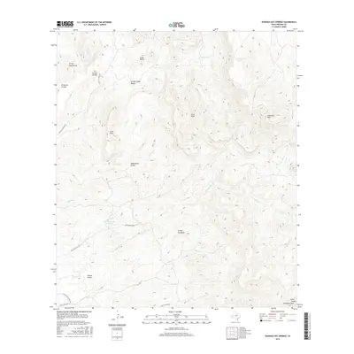
2016 Map of Ruidosa Hot Springs
USGS Topo · Published 2016About this map
Ruidosa Hot Springs and other geothermal vents define the remote drainage patterns of Presidio County in this high-desert landscape. The terrain is marked by a complex network of dry washes and canyons, including Arroyo Escondido, Tijeras Arroyo, and Arroyo Chupaderos, which descend from prominent local heights like Cleveland Peak and Loma Blanca. Transportation through this isolated region is restricted to a few established routes such as Hot Springs Rd and Pinto Canyon Rd. The map illustrates the convergence of numerous ephemeral watercourses, such as Naegele Cr and Hot Springs Cr, which feed into the broader valley system. Named topographical features like Cerro Chino and Cerro Pardo provide essential navigational landmarks for researchers tracing land use and natural resources in this arid part of the Texas borderlands.
Find a feature on this map
24 named features on this map. Tap any name to fly to it.
Don’t see what you’re looking for? This feature index may not catch every label — zoom into the map to look around manually.
Map Details
Editions of this 2016 Ruidosa Hot Springs Map
This is the sole edition of this map. No revisions or reprints were ever made.
Other maps of this area

1895 · Marfa
USGS Topo · 1:125,000

1896 · Ruidosa
USGS Topo · 1:125,000

1896 · San Carlos
USGS Topo · 1:125,000

1896 · Shafter
USGS Topo · 1:125,000

1959 · Presidio
USGS Topo · 1:250,000

1959 · Marfa
USGS Topo · 1:250,000

1965 · Presidio
USGS Topo · 1:250,000

1965 · Marfa
USGS Topo · 1:250,000

1978 · Sierra Parda
USGS Topo · 1:24,000

1979 · Ruidosa Hot Springs
USGS Topo · 1:24,000