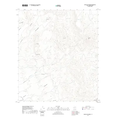
2019 Map of Ruidosa Hot Springs
USGS Topo · Published 2019About this map
Ruidosa Hot Springs and the surrounding thermal waters define this high-elevation corner of Presidio County. The landscape is characterized by a complex drainage network that includes Hot Springs Cr, Sanguijuela Arroyo, and Naegele Cr, all carved into the arid terrain. Prominent peaks such as Cleveland Peak and Cerro Pardo rise above the basin, providing clear landmarks in this sparsely populated territory. The presence of water sources like Perdis Tank and Ojo Carrizo suggests the essential nature of these points for ranching or travel through the rugged Chihuahuan Desert. Movement across the region is facilitated by routes such as Hot Springs Rd and Pinto Canyon Rd, which connect the isolated springs and summits.
Find a feature on this map
24 named features on this map. Tap any name to fly to it.
Don’t see what you’re looking for? This feature index may not catch every label — zoom into the map to look around manually.
Map Details
Editions of this 2019 Ruidosa Hot Springs Map
This is the sole edition of this map. No revisions or reprints were ever made.
Other maps of this area

1895 · Marfa
USGS Topo · 1:125,000

1896 · Ruidosa
USGS Topo · 1:125,000

1896 · San Carlos
USGS Topo · 1:125,000

1896 · Shafter
USGS Topo · 1:125,000

1959 · Presidio
USGS Topo · 1:250,000

1959 · Marfa
USGS Topo · 1:250,000

1965 · Presidio
USGS Topo · 1:250,000

1965 · Marfa
USGS Topo · 1:250,000

1978 · Sierra Parda
USGS Topo · 1:24,000

1979 · Ruidosa Hot Springs
USGS Topo · 1:24,000