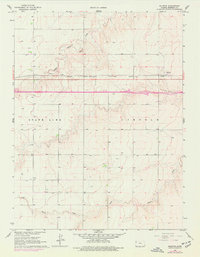
1966 Map of Ruleton
USGS Topo · Published 1977About this map
The settlement of Ruleton sits at a critical junction of mid-century prairie transportation, positioned along the Chicago Rock Island and Pacific railroad in Sherman County. This landscape is defined by the drainage patterns of Middle Beaver Creek, South Beaver Creek, and the main channel of Beaver Creek, which carve subtle topography into the High Plains. The transition between the high ground and the creek beds is marked by scattered Sandpits, indicating local extraction industries tied to the rail and road network.
Find a feature on this map
10 named features on this map. Tap any name to fly to it.
Don’t see what you’re looking for? This feature index may not catch every label — zoom into the map to look around manually.
Map Details
Editions of this 1966 Ruleton Map
2 editions found
Other maps of this area

1954 · Limon
USGS Topo · 1:250,000

1954 · Goodland
USGS Topo · 1:250,000

1956 · Goodland
USGS Topo · 1:250,000

1957 · Limon
USGS Topo · 1:250,000

1957 · Goodland
USGS Topo · 1:250,000

1958 · Limon
USGS Topo · 1:250,000

1959 · Horsethief Draw
USGS Topo · 1:62,500

1966 · Ruleton NW
USGS Topo · 1:24,000

1966 · Ruleton NE
USGS Topo · 1:24,000

1966 · Ruleton
USGS Topo · 1:24,000