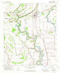
1966 Map of Ruleville
USGS Topo · Published 1967About this map
The Big Sunflower River meanders through the heart of this Sunflower County landscape, defining the agricultural and transport patterns of the mid-1960s. The town of Ruleville serves as the primary hub, situated along the Illinois Central railroad corridor which also connects the smaller settlements of Doddsville, Cottondale, and Eastland. The mapping reveals a rural infrastructure deeply tied to local family names and small-town congregations, preserved through numerous cemeteries and churches such as Hillhouse Cem, Mt Zion Cem, and True Light Ch.
Find a feature on this map
41 named features on this map. Tap any name to fly to it.
Don’t see what you’re looking for? This feature index may not catch every label — zoom into the map to look around manually.
Map Details
Editions of this 1966 Ruleville Map
2 editions found
Other maps of this area

1931 · Schlater
USGS Topo · 1:48,000

1931 · Sumner
USGS Topo · 1:48,000

1931 · Drew
USGS Topo · 1:48,000

1934 · Cleveland
USGS Topo · 1:62,500

1934 · Schlater
USGS Topo · 1:62,500

1935 · Sumner
USGS Topo · 1:62,500

1935 · Mound Bayou
USGS Topo · 1:62,500

1939 · Schlater
USGS Topo · 1:62,500

1939 · Sumner
USGS Topo · 1:62,500

1940 · Cleveland
USGS Topo · 1:62,500