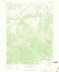
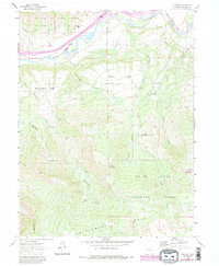
1960 Map of Rulison
USGS Topo · Published 1971About this map
Morrisania Mesa and the settlement of Rulison anchor this 1960s survey of the Colorado River valley, where agricultural benches meet industrial resource extraction. The landscape is defined by the sharp transition from the river corridor—serviced by the Denver and Rio Grande Western River—to the high elevations of Holms Mesa and the White River National Forest. Evidence of the region’s energy history is prominent, specifically within the Naval Oil Shale Reserve and the presence of scattered Gas Wells.
Find a feature on this map
27 named features on this map. Tap any name to fly to it.
Don’t see what you’re looking for? This feature index may not catch every label — zoom into the map to look around manually.
Map Details
Editions of this 1960 Rulison Map
5 editions found
Other maps of this area

1906 · Grand Hogback
USGS Topo · 1:125,000

1910 · Grand Hogback
USGS Topo · 1:125,000

1925 · Parachute Creek
USGS Topo · 1:62,500

1927 · Parachute Creek
USGS Topo · 1:62,500

1929 · Grand Valley
USGS Topo · 1:62,500

1952 · Anvil Points
USGS Topo · 1:24,000

1952 · Rifle
USGS Topo · 1:24,000

1956 · Grand Junction
USGS Topo · 1:250,000

1957 · Leadville
USGS Topo · 1:250,000

1959 · Grand Junction
USGS Topo · 1:250,000