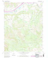
1960 Map of Rulison
USGS Topo · Published 1988About this map
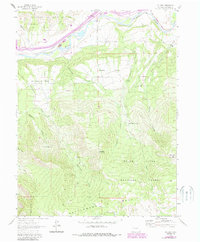
The Colorado River corridor defines the northern reach of this 1960 survey, where the small settlement of Rulison and the agricultural expanse of Morrisania Mesa sit at the foot of massive highlands. The landscape is a study in resource management and extraction, dominated by the Naval Oil Shale Reserve and the expansive White River National Forest. Industrial markers like an Old Railroad Grade, several Gas Wells, and a Stone Quarry trace the economic footprint of the mid-20th century. High-altitude landmarks such as Battlement Mesa, Doghead Mountain, and Houston Mountain rise sharply above the river valley, while irrigation features like the Hallett Ditch suggest the complex water engineering required to sustain life on the arid mesas. Revisions from 1983 aerial photography, shown in purple, document a landscape being reshaped by new pipelines and evolving road networks.
Find a feature on this map
27 named features on this map. Tap any name to fly to it.
Don’t see what you’re looking for? This feature index may not catch every label — zoom into the map to look around manually.
Map Details
Editions of this 1960 Rulison Map
5 editions found
Other maps of this area

1906 · Grand Hogback
USGS Topo · 1:125,000

1910 · Grand Hogback
USGS Topo · 1:125,000

1925 · Parachute Creek
USGS Topo · 1:62,500

1927 · Parachute Creek
USGS Topo · 1:62,500

1929 · Grand Valley
USGS Topo · 1:62,500

1952 · Anvil Points
USGS Topo · 1:24,000

1952 · Rifle
USGS Topo · 1:24,000

1956 · Grand Junction
USGS Topo · 1:250,000

1957 · Leadville
USGS Topo · 1:250,000

1959 · Grand Junction
USGS Topo · 1:250,000