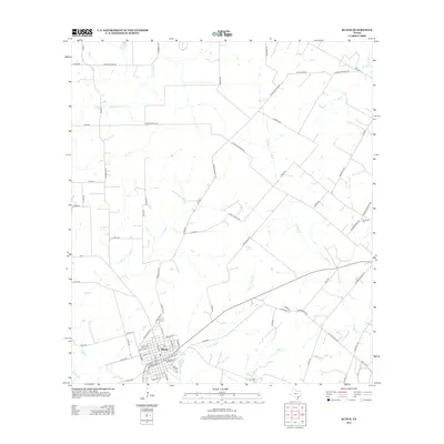
2013 Map of Runge
USGS Topo · Published 2013About this map
Runge serves as the primary hub in this portion of South Texas, where a grid of streets meets the winding course of Ojo de Agua Cr. This 2013 survey illustrates a landscape dominated by ranching and agriculture, with numerous private roads named after local families such as Simpson Ranch Rd, Alfred Blaschke Rd, and Ryan Ranch Rd. The drainage patterns of the coastal plains are clearly defined by a network of creeks including Cabeza Cr, McTennel Cr, and Ecleto Cr, which carve through the level terrain.
Find a feature on this map
84 named features on this map. Tap any name to fly to it.
Don’t see what you’re looking for? This feature index may not catch every label — zoom into the map to look around manually.
Map Details
Editions of this 2013 Runge Map
This is the sole edition of this map. No revisions or reprints were ever made.
Other maps of this area

1920 · Smiley
USGS Topo · 1:125,000

1953 · Beeville
USGS Topo · 1:250,000

1953 · Seguin
USGS Topo · 1:250,000

1956 · Beeville
USGS Topo · 1:250,000

1956 · Karnes City
USGS Topo · 1:62,500

1958 · Seguin
USGS Topo · 1:250,000

1960 · Beeville
USGS Topo · 1:250,000

1960 · Helena
USGS Topo · 1:24,000
1961 · Kenedy
USGS Topo · 1:24,000

1961 · New Davy
USGS Topo · 1:24,000