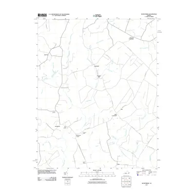
2011 Map of Runnymede
USGS Topo · Published 2011About this map
Mill Swamp and Passenger Swamp dominate this landscape, illustrating the complex hydrology of Surry County as it drains toward the Blackwater River and Lower Chippokes Creek. Small communities and crossroads like Runnymede, Moorings, and California Crossroads are connected by a network of rural routes, including Golden Hill Rd and White Marsh Rd. The map reveals a deep connection to local heritage through several family and community landmarks, such as Moores Swamp Cemetery and Mount Moriah Cemetery. Industry and infrastructure are represented by Derrings Mill and the small Wells Airport, while Hundreds Bridge provides a key crossing over the swampy terrain near Berrymans Corner.
Find a feature on this map
42 named features on this map. Tap any name to fly to it.
Don’t see what you’re looking for? This feature index may not catch every label — zoom into the map to look around manually.
Map Details
Editions of this 2011 Runnymede Map
This is the sole edition of this map. No revisions or reprints were ever made.
Other maps of this area

1907 · Yorktown
USGS Topo · 1:62,500

1919 · Smithfield
USGS Topo · 1:62,500

1919 · Surry
USGS Topo · 1:62,500

1920 · Ivor
USGS Topo · 1:62,500

1943 · Yorktown
USGS Topo · 1:62,500

1943 · Richmond
USGS Topo · 1:250,000

1944 · Ivor
USGS Topo · 1:24,000

1944 · Smithfield
USGS Topo · 1:24,000

1944 · Raynor
USGS Topo · 1:24,000
1945 · Ivor
USGS Topo · 1:31,680