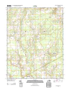
2013 Map of Runnymede
USGS Topo · Published 2013About this map
Mill Swamp and its numerous tributaries, including Lumber Run and Golden Hill Br, define the hydrological character of this coastal plain landscape. Small, dispersed settlements like Runnymede and Berrymans Corner are connected by rural corridors such as White Marsh Rd, which crosses the swampy lowlands at Hundreds Bridge. The map records a quiet, agricultural and timbered region punctuated by small aviation sites like Beaver Dam Airpark and Wells Airport.
Find a feature on this map
27 named features on this map. Tap any name to fly to it.
Don’t see what you’re looking for? This feature index may not catch every label — zoom into the map to look around manually.
Map Details
Editions of this 2013 Runnymede Map
This is the sole edition of this map. No revisions or reprints were ever made.
Other maps of this area

1907 · Yorktown
USGS Topo · 1:62,500

1919 · Smithfield
USGS Topo · 1:62,500

1919 · Surry
USGS Topo · 1:62,500

1920 · Ivor
USGS Topo · 1:62,500

1943 · Yorktown
USGS Topo · 1:62,500

1943 · Richmond
USGS Topo · 1:250,000

1944 · Ivor
USGS Topo · 1:24,000

1944 · Smithfield
USGS Topo · 1:24,000

1944 · Raynor
USGS Topo · 1:24,000
1945 · Ivor
USGS Topo · 1:31,680