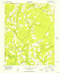
1954 Map of Runnymede
USGS Topo · Published 1957About this map
The Blackwater River and its dense network of swamps define this rural landscape on the border of Surry and Isle of Wight counties. Extensive marshy lowlands such as Willy Cox Pocosin and Cypress Pocosin dominate the central terrain, limiting development to higher ground where settlements like Runnymede and Beachland took root. The map illustrates a society connected by wood-and-water industry, evidenced by Derrings Mill situated along Mill Branch.
Find a feature on this map
38 named features on this map. Tap any name to fly to it.
Don’t see what you’re looking for? This feature index may not catch every label — zoom into the map to look around manually.
Map Details
Editions of this 1954 Runnymede Map
This is the sole edition of this map. No revisions or reprints were ever made.
Other maps of this area

1907 · Yorktown
USGS Topo · 1:62,500

1919 · Smithfield
USGS Topo · 1:62,500

1919 · Surry
USGS Topo · 1:62,500

1920 · Ivor
USGS Topo · 1:62,500

1943 · Yorktown
USGS Topo · 1:62,500

1943 · Richmond
USGS Topo · 1:250,000

1944 · Ivor
USGS Topo · 1:24,000

1944 · Smithfield
USGS Topo · 1:24,000

1944 · Raynor
USGS Topo · 1:24,000
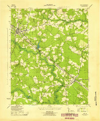
1945 · Ivor
USGS Topo · 1:31,680