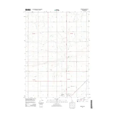
2013 Map of Rupert NW
USGS Topo · Published 2013About this map
Rupert anchors the southeast corner of this survey, revealing a landscape defined by an extensive reclamation infrastructure. The rectilinear grid of the Magic Valley is evident here, crisscrossed by essential water management features like the F Main Drain, B Canal, and B-1 Canal. These man-made arteries supported the transformation of the Snake River Plain into productive farmland. Near the city limits, the Rupert Cem and Irrigation Canal Acc mark the intersection of civic life and the region's agricultural lifeline.
Find a feature on this map
51 named features on this map. Tap any name to fly to it.
Don’t see what you’re looking for? This feature index may not catch every label — zoom into the map to look around manually.
Map Details
Editions of this 2013 Rupert NW Map
This is the sole edition of this map. No revisions or reprints were ever made.
Other maps of this area

1954 · Pocatello
USGS Topo · 1:250,000

1958 · Pocatello
USGS Topo · 1:250,000

1964 · Rupert SE
USGS Topo · 1:24,000

1964 · Burley NE
USGS Topo · 1:24,000

1964 · Rupert NW
USGS Topo · 1:24,000

1964 · Acequia
USGS Topo · 1:24,000

1964 · Rupert SW
USGS Topo · 1:24,000

1964 · Burley SE
USGS Topo · 1:24,000

1972 · Kimama
USGS Topo · 1:24,000

1972 · Max
USGS Topo · 1:24,000