
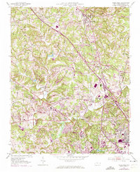
1951 Map of Rural Hall
USGS Topo · Published 1952About this map
The Moravian heritage of Forsyth County is evident across this mid-century landscape, centered on the historic village of Bethania. The terrain is defined by the three civil districts of Old Richmond, Bethania, and Old Town, where small crossroads communities like Tobaccoville and Pfafftown are connected by a network of local roads and the Southern railroad. To the north, Rural Hall serves as a transportation hub, while the southern reach of the map transitions into the suburban edges of Winston-Salem near Reynolda and the County Fairgrounds.
Find a feature on this map
72 named features on this map. Tap any name to fly to it.
Don’t see what you’re looking for? This feature index may not catch every label — zoom into the map to look around manually.
Map Details
Editions of this 1951 Rural Hall Map
4 editions found
Other maps of this area

1950 · Winston-Salem West
USGS Topo · 1:24,000

1950 · Winston-Salem East
USGS Topo · 1:24,000

1951 · Winston-Salem West
USGS Topo · 1:24,000

1951 · Winston-Salem East
USGS Topo · 1:24,000

1951 · Walkertown
USGS Topo · 1:24,000

1953 · Winston-Salem
USGS Topo · 1:250,000

1955 · Winston-Salem
USGS Topo · 1:250,000

1962 · Winston-Salem
USGS Topo · 1:250,000

1964 · Pinnacle
USGS Topo · 1:24,000

1964 · King
USGS Topo · 1:24,000