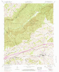
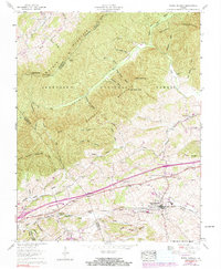
1959 Map of Rural Retreat
USGS Topo · Published 1984About this map
Rural Retreat serves as a central hub on this mid-century survey, positioned along the Norfolk and Western rail line and the Lee Highway. The landscape is defined by the parallel ridges of Walker Mountain and Brushy Mountain, which separate the Rich Valley from the Kimberlin Valley. Higher elevations are preserved within the Jefferson National Forest, where the Appalachian Trail traverses the southwestern ridges near Little Brushy Mountain.
Find a feature on this map
73 named features on this map. Tap any name to fly to it.
Don’t see what you’re looking for? This feature index may not catch every label — zoom into the map to look around manually.
Map Details
Editions of this 1959 Rural Retreat Map
5 editions found
Other maps of this area

1887 · Pocahontas
USGS Topo · 1:125,000

1889 · Wytheville
USGS Topo · 1:125,000

1891 · Pocahontas
USGS Topo · 1:125,000

1892 · Wytheville
USGS Topo · 1:125,000

1894 · Pocahontas
USGS Topo · 1:125,000

1895 · Pocahontas
USGS Topo · 1:125,000

1930 · Speedwell
USGS Topo · 1:62,500

1931 · Rural Retreat
USGS Topo · 1:48,000

1935 · Nebo
USGS Topo · 1:24,000

1935 · Cedar Springs
USGS Topo · 1:24,000