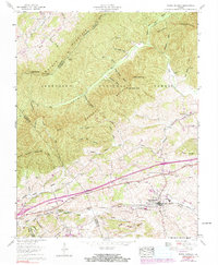
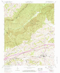
1959 Map of Rural Retreat
USGS Topo · Published 1991About this map
Rural Retreat serves as the primary hub of this Wythe County landscape, situated along the Norfolk and Western railroad corridor. The area’s transportation history is deeply etched into the topography, with the Lee Highway and the Mountain Empire Airport supporting local transit through the Tenn Valley. North of the settlement, the Jefferson National Forest covers the ridges of Walker Mountain, where the Walker Mountain Lookout Tower stands near Redding Gap. The rural character of the mid-20th century is evident in the numerous country churches and crossroads, such as Groseclose, Staley Crossroads, and Mt Olive Ch. Recreational and wilderness routes are represented by the Appalachian Trail winding through the northern ridges. This Tennessee Valley Authority survey provides clear evidence of the region's agricultural and transit-based economy before the full impact of modern interstate development altered the local valley patterns.
Find a feature on this map
66 named features on this map. Tap any name to fly to it.
Don’t see what you’re looking for? This feature index may not catch every label — zoom into the map to look around manually.
Map Details
Editions of this 1959 Rural Retreat Map
5 editions found
Other maps of this area

1887 · Pocahontas
USGS Topo · 1:125,000

1889 · Wytheville
USGS Topo · 1:125,000

1891 · Pocahontas
USGS Topo · 1:125,000

1892 · Wytheville
USGS Topo · 1:125,000

1894 · Pocahontas
USGS Topo · 1:125,000

1895 · Pocahontas
USGS Topo · 1:125,000

1930 · Speedwell
USGS Topo · 1:62,500

1931 · Rural Retreat
USGS Topo · 1:48,000

1935 · Nebo
USGS Topo · 1:24,000

1935 · Cedar Springs
USGS Topo · 1:24,000