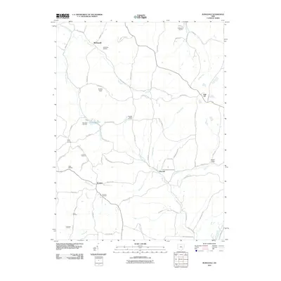
2010 Map of Ruraldale
USGS Topo · Published 2010About this map
Museville and Ruraldale anchor this Muskingum County landscape, where the ridges and valleys of south-central Ohio dictate the layout of small settlements and isolated farmsteads. The terrain is marked by distinct geographical hollows, such as Harmony Hollow and Sleepy Hollow, alongside the deep-cut watershed of Meigs Creek and Manns Fork Salt Creek. This map reveals a significant concentration of burial grounds, providing an essential resource for genealogists researching family names associated with Oakland Methodist Cemetery, Bethlehem Cemetery, and Stone Church Cemetery.
Find a feature on this map
67 named features on this map. Tap any name to fly to it.
Don’t see what you’re looking for? This feature index may not catch every label — zoom into the map to look around manually.
Map Details
Editions of this 2010 Ruraldale Map
This is the sole edition of this map. No revisions or reprints were ever made.
Other maps of this area

1909 · Caldwell
USGS Topo · 1:62,500

1910 · Philo
USGS Topo · 1:62,500

1910 · Mc Connelsville
USGS Topo · 1:62,500

1911 · Cumberland
USGS Topo · 1:62,500

1912 · Caldwell
USGS Topo · 1:62,500

1949 · Clarksburg
USGS Topo · 1:250,000

1956 · Clarksburg
USGS Topo · 1:250,000

1961 · Clarksburg
USGS Topo · 1:250,000

1961 · Mc Connelsville
USGS Topo · 1:24,000
1961 · Rokeby Lock
USGS Topo · 1:24,000