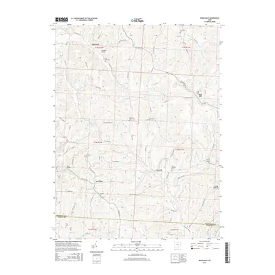
2016 Map of Ruraldale
USGS Topo · Published 2016About this map
Ruraldale and Museville anchor this portion of southeastern Muskingum County, where the landscape is defined by the winding drainages of Meigs Creek and Kent Run. The area's settlement history is evident in the numerous burial grounds and spiritual centers that dot the ridge lines and hollows, including the Oakland Methodist Cemetery and the Stone Church near Coal Hollow. To the north, the elevation rises toward High Hill, while the central portion of the map features the recreational waters of Cutler Lake. This 2016 survey captures the rural character of the Muskingum and Morgan County border, documenting a network of township roads and county highways that link long-standing communities like Young Hickory and McDonald through the varied terrain of Harmony Hollow.
Find a feature on this map
84 named features on this map. Tap any name to fly to it.
Don’t see what you’re looking for? This feature index may not catch every label — zoom into the map to look around manually.
Map Details
Editions of this 2016 Ruraldale Map
This is the sole edition of this map. No revisions or reprints were ever made.
Other maps of this area

1909 · Caldwell
USGS Topo · 1:62,500

1910 · Philo
USGS Topo · 1:62,500

1910 · Mc Connelsville
USGS Topo · 1:62,500

1911 · Cumberland
USGS Topo · 1:62,500

1912 · Caldwell
USGS Topo · 1:62,500

1949 · Clarksburg
USGS Topo · 1:250,000

1956 · Clarksburg
USGS Topo · 1:250,000

1961 · Clarksburg
USGS Topo · 1:250,000

1961 · Mc Connelsville
USGS Topo · 1:24,000
1961 · Rokeby Lock
USGS Topo · 1:24,000