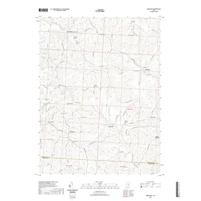
2019 Map of Ruraldale
USGS Topo · Published 2019About this map
Ruraldale and Museville anchor this portion of the Muskingum and Morgan County line, a landscape defined by the branching tributaries of Kent Run and Meigs Cr. The terrain is marked by numerous family and community burial grounds, including the Stone Church Cem and Allens Cem, which serve as quiet markers of the area's ancestral settlement. These sites are linked by a dense network of township and county roads such as Rockville Rd and Cutler Lake Rd, tracing the ridgelines and hollows of the Appalachian Plateau.
Find a feature on this map
87 named features on this map. Tap any name to fly to it.
Don’t see what you’re looking for? This feature index may not catch every label — zoom into the map to look around manually.
Map Details
Editions of this 2019 Ruraldale Map
This is the sole edition of this map. No revisions or reprints were ever made.
Other maps of this area

1909 · Caldwell
USGS Topo · 1:62,500

1910 · Philo
USGS Topo · 1:62,500

1910 · Mc Connelsville
USGS Topo · 1:62,500

1911 · Cumberland
USGS Topo · 1:62,500

1912 · Caldwell
USGS Topo · 1:62,500

1949 · Clarksburg
USGS Topo · 1:250,000

1956 · Clarksburg
USGS Topo · 1:250,000

1961 · Clarksburg
USGS Topo · 1:250,000

1961 · Mc Connelsville
USGS Topo · 1:24,000
1961 · Rokeby Lock
USGS Topo · 1:24,000