
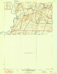
1934 Map of Rush
USGS Topo · Published 1934About this map
The Genesee River carves a winding path along the western boundary of this agricultural and rail corridor, where the border of Monroe and Livingston counties meets. During the mid-1930s, this landscape was defined by an intricate web of competing rail lines, including the Erie Railroad, Lehigh Valley Railroad, and New York Central Railroad, which intersected at strategic hamlets like Golah and West Rush. The terrain is characterized by the glacial topography of Ryder Hill and the valley of Honeoye Creek, which flows westward to join the Genesee.
Find a feature on this map
33 named features on this map. Tap any name to fly to it.
Don’t see what you’re looking for? This feature index may not catch every label — zoom into the map to look around manually.
Map Details
Editions of this 1934 Rush Map
2 editions found
Other maps of this area

1895 · Rochester
USGS Topo · 1:62,500

1898 · Rochester
USGS Topo · 1:62,500

1899 · Brockport
USGS Topo · 1:62,500

1901 · Honeoye
USGS Topo · 1:62,500

1904 · Caledonia
USGS Topo · 1:62,500

1904 · Honeoye
USGS Topo · 1:62,500

1912 · Rochester
USGS Topo · 1:62,500

1920 · Rochester
USGS Topo · 1:62,500

1931 · Mendon Ponds
USGS Topo · 1:24,000
1934 · Honeoye Falls
USGS Topo · 1:24,000