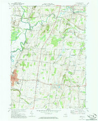
1971 Map of Rush
USGS Topo · Published 1973About this map
The Genesee River and its major tributaries, Honeoye Creek and Conesus Creek, define the topography of this region during the early 1970s. The landscape reflects a transition from traditional rural hamlets like Rush and West Rush toward more modern infrastructure, marked by a network of pipelines and a prominent Radio Tower. Transportation history is clearly etched into the land, featuring the routes of the Lehigh Valley and Erie-Lackawanna railroads, alongside an Old Railroad Grade that speaks to the area's evolving transit patterns.
Find a feature on this map
54 named features on this map. Tap any name to fly to it.
Don’t see what you’re looking for? This feature index may not catch every label — zoom into the map to look around manually.
Map Details
Editions of this 1971 Rush Map
Other maps of this area

1895 · Rochester
USGS Topo · 1:62,500

1898 · Rochester
USGS Topo · 1:62,500

1899 · Brockport
USGS Topo · 1:62,500

1901 · Honeoye
USGS Topo · 1:62,500

1904 · Caledonia
USGS Topo · 1:62,500

1904 · Honeoye
USGS Topo · 1:62,500

1912 · Rochester
USGS Topo · 1:62,500

1920 · Rochester
USGS Topo · 1:62,500

1931 · Mendon Ponds
USGS Topo · 1:24,000

1934 · Rush
USGS Topo · 1:24,000