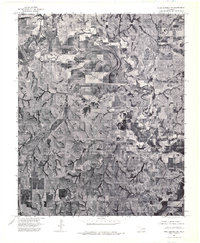
1975 Map of Rush Springs NE
USGS Topo · Published 1976About this map
The meandering Washita River dominates the northern landscape of this Grady County orthophotoquad, its complex oxbows and floodplains contrasting sharply with the geometric grid of agricultural fields below. This aerial perspective, captured in the mid-1970s, reveals the town of Alex situated at the crossroads of regional movement, serving as a primary focal point for the surrounding rural homesteads. Unlike traditional topographic sheets, this photographic map provides a raw look at the land use of the era, showing the intricate drainage patterns of the southern plains and the expansion of residential and commercial structures along the primary road network. The concentration of development in the southeastern sector highlights the town's role as a local hub amidst the vast, cultivated terrain of the Oklahoma interior.
Find a feature on this map
2 named features on this map. Tap any name to fly to it.
Don’t see what you’re looking for? This feature index may not catch every label — zoom into the map to look around manually.
Map Details
Editions of this 1975 Rush Springs NE Map
This is the sole edition of this map. No revisions or reprints were ever made.
Other maps of this area

1902 · Rush Springs
USGS Topo · 1:125,000

1904 · Chickasha
USGS Topo · 1:125,000

1949 · Rush Springs
USGS Topo · 1:62,500

1950 · Rush Springs
USGS Topo · 1:62,500

1954 · Oklahoma City
USGS Topo · 1:250,000

1957 · Ardmore
USGS Topo · 1:250,000

1957 · Oklahoma City
USGS Topo · 1:250,000

1963 · Ardmore
USGS Topo · 1:250,000

1963 · Oklahoma City
USGS Topo · 1:250,000
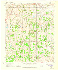
1965 · Dibble
USGS Topo · 1:24,000