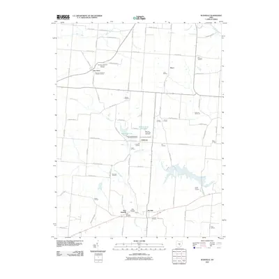
2010 Map of Rushville
USGS Topo · Published 2010About this map
Rushville and West Rushville anchor the southern landscape of this 2010 survey, separated by the winding course of Little Rush Creek. The area is notably dense with family and denominational burial grounds, serving as a significant record for genealogists. Clusters such as the New Salem Methodist Episcopal Cemetery and the New Salem Methodist Protestant Cemetery near New Salem reflect the deep-rooted religious history of the township. Further north, the landscape transitions toward water management and recreation, centered on Rush Creek Lake and the Memory Lanes Park Lake, which are regulated by the Rush Creek Watershed Structure VI-D Dam. Smaller settlements like Oakthorpe and Bruno are connected by an intricate grid of township roads, including Township Road 15 and Ridenour Rd, highlighting the enduring rural infrastructure of Fairfield County.
Find a feature on this map
82 named features on this map. Tap any name to fly to it.
Don’t see what you’re looking for? This feature index may not catch every label — zoom into the map to look around manually.
Map Details
Editions of this 2010 Rushville Map
This is the sole edition of this map. No revisions or reprints were ever made.
Other maps of this area

1907 · Logan
USGS Topo · 1:62,500

1907 · Lancaster
USGS Topo · 1:62,500

1907 · Thurston
USGS Topo · 1:62,500

1909 · Thornville
USGS Topo · 1:62,500

1909 · Lancaster
USGS Topo · 1:62,500

1909 · Logan
USGS Topo · 1:62,500

1909 · Thurston
USGS Topo · 1:62,500

1947 · Columbus
USGS Topo · 1:250,000

1961 · Columbus
USGS Topo · 1:250,000
1961 · Millersport
USGS Topo · 1:24,000