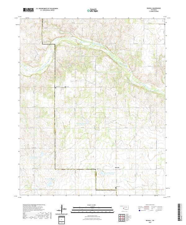
2022 Map of Russell
USGS Topo · Published 2022About this map
Russell stands as a primary point of reference in this southwestern Oklahoma landscape where the Harmon and Greer County line marks a significant administrative boundary. The terrain is defined by the winding course of the Salt Fork Red River and its various tributaries, including Cave Creek and Turkey Creek. This 2022 survey details a modern landscape of water management, illustrated by several engineered water bodies such as Tri-County Turkey Cr Site 15 and Site 4 Reservoir. Genealogists will find the area particularly significant for its well-documented burial grounds. Scattered across the township sections are historical sites like Wildcat Cemetery, Langford Cemetery, and the northern White Flat Cemetery, which offer valuable clues to the early settlement patterns of these high plains.
Find a feature on this map
39 named features on this map. Tap any name to fly to it.
Don’t see what you’re looking for? This feature index may not catch every label — zoom into the map to look around manually.
Map Details
Editions of this 2022 Russell Map
This is the sole edition of this map. No revisions or reprints were ever made.
Other maps of this area

1955 · Lawton
USGS Topo · 1:250,000

1961 · Hollis
USGS Topo · 1:62,500

1971 · Russell
USGS Topo · 1:24,000

1971 · Mangum North
USGS Topo · 1:24,000

1971 · Vinson
USGS Topo · 1:24,000

1971 · Mangum South
USGS Topo · 1:24,000

1971 · Mc Queen
USGS Topo · 1:24,000

1971 · Duke
USGS Topo · 1:24,000

1971 · Reed
USGS Topo · 1:24,000
1971 · Shrewder
USGS Topo · 1:24,000