
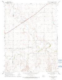
1969 Map of Russell Springs 2 NW
USGS Topo · Published 1971About this map
The Butterfield Overland Trail cuts across this High Plains landscape, marking a path of historic western migration through Logan and Wallace Counties. Running parallel to the Smoky Hill River, the trail's path is noted by several Historical Markers, including one at an approximate location for the overland route. The terrain is defined by the winding river valley and its tributaries like Lake Creek and Turkey Creek, which create a complex system of draws and bluffs. The northern portion of the map is dominated by the Union Pacific railroad, illustrating the shift from wagon trails to steam-powered transportation. Numerous Wells are scattered throughout the quadrangle, indicating the vital importance of groundwater for ranching and settlement in this semi-arid region. A solitary Quarry in the southeast corner provides evidence of local mineral extraction in the late 1960s.
Find a feature on this map
13 named features on this map. Tap any name to fly to it.
Don’t see what you’re looking for? This feature index may not catch every label — zoom into the map to look around manually.
Map Details
Editions of this 1969 Russell Springs 2 NW Map
2 editions found
Other maps of this area

1954 · Goodland
USGS Topo · 1:250,000

1955 · Scott City
USGS Topo · 1:250,000

1956 · Goodland
USGS Topo · 1:250,000

1957 · Goodland
USGS Topo · 1:250,000

1958 · Scott City
USGS Topo · 1:250,000

1959 · Wallace
USGS Topo · 1:62,500

1959 · Harris Draw
USGS Topo · 1:62,500

1969 · Mc Allaster SE
USGS Topo · 1:24,000

1969 · Russell Springs 2 SW
USGS Topo · 1:24,000

1969 · Russell Springs 2 NE
USGS Topo · 1:24,000