
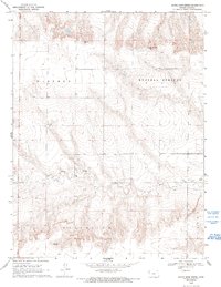
1969 Map of Russell Springs 2 SE
USGS Topo · Published 1971About this map
Twin Butte Creek meanders through the central and southern portions of this High Plains landscape, cutting across the townships of Augustine and Paxton. Surveyed in the late 1960s, the map reveals a sparsely populated region of Logan County characterized by its water sources and small-scale industrial extractions. Significant landmarks include Nickel Mine Spring and several unnamed Spring sites that provided essential water in this semi-arid environment. Evidence of local resource use is found in the scattered Quarry and Gravel Pit locations, likely supporting the development of the area's light-duty road network. The terrain is divided into large sections such as Western and Russell Springs, reflecting the expansive land divisions typical of western Kansas ranching and farming tracts during this era.
Find a feature on this map
13 named features on this map. Tap any name to fly to it.
Don’t see what you’re looking for? This feature index may not catch every label — zoom into the map to look around manually.
Map Details
Editions of this 1969 Russell Springs 2 SE Map
2 editions found
Other maps of this area

1939 · Pence
USGS Topo · 1:62,500

1941 · Pence
USGS Topo · 1:62,500

1955 · Scott City
USGS Topo · 1:250,000

1958 · Scott City
USGS Topo · 1:250,000

1968 · Russell Springs 3 NW
USGS Topo · 1:24,000

1968 · Russell Springs 3 NE
USGS Topo · 1:24,000

1969 · Russell Springs 2 NW
USGS Topo · 1:24,000

1969 · Russell Springs 2 SW
USGS Topo · 1:24,000

1969 · Russell Springs 2 NE
USGS Topo · 1:24,000

1972 · Russell Springs
USGS Topo · 1:24,000