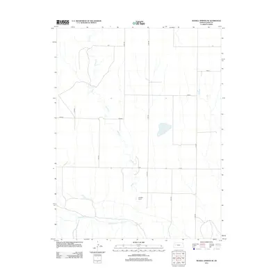
2012 Map of Russell Springs NE
USGS Topo · Published 2012About this map
The Smoky Hill River meanders across the southern portion of this Logan County landscape, a vital watercourse in an area defined by the vast Plains. This U.S. Geological Survey 2012 topographic study reveals a terrain carved by drainage systems like Sixmile Cr, which feeds into the larger river valley through the Six Mile Gulch. The grid of the High Plains is evident in the systematic road network, where local routes carry names like Topeka, Seneca, and Rawhide. This map captures the agricultural and geographical character of western Kansas, showing how modern county roads like Co RD-320 and Co RD-330 follow the section lines of the original land surveys, providing a clear view of the rural infrastructure as it existed in the early 21st century.
Find a feature on this map
14 named features on this map. Tap any name to fly to it.
Don’t see what you’re looking for? This feature index may not catch every label — zoom into the map to look around manually.
Map Details
Editions of this 2012 Russell Springs NE Map
This is the sole edition of this map. No revisions or reprints were ever made.
Other maps of this area

1954 · Goodland
USGS Topo · 1:250,000

1955 · Scott City
USGS Topo · 1:250,000

1956 · Goodland
USGS Topo · 1:250,000

1957 · Goodland
USGS Topo · 1:250,000

1958 · Scott City
USGS Topo · 1:250,000

1972 · Russell Springs
USGS Topo · 1:24,000

1972 · Monument
USGS Topo · 1:24,000
1972 · Winona
USGS Topo · 1:24,000

1972 · Elkader NW
USGS Topo · 1:24,000
1972 · Russell Springs NE
USGS Topo · 1:24,000