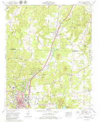
1971 Map of Russellville
USGS Topo · Published 1980About this map
Russellville serves as the focal point for this 1971 study, where the Southern Railway line cuts through the heart of the settlement alongside U.S. Highway 43. The landscape around the county seat is a complex arrangement of residential developments like Hester Heights and Woodlawn Heights juxtaposed with an active industrial footprint of numerous strip mines and gravel pits. To the north, Littleville sits at the intersection of the railway and the Old Jackson Highway, while the eastern hills are defined by Underwood Mountain and Coburn Mountain. Local life in the early 1970s is reflected in the mapping of the Twin Pines Golf Course, a drive-in theater, and several country churches like Siloam Ch. Genealogy researchers will find numerous family-named landmarks and burial sites, including Henson Cem, Tharp Cem, and the Knights of Pythias Cem.
Find a feature on this map
98 named features on this map. Tap any name to fly to it.
Don’t see what you’re looking for? This feature index may not catch every label — zoom into the map to look around manually.
Map Details
Editions of this 1971 Russellville Map
3 editions found
Other maps of this area

1924 · Tuscumbia
USGS Topo · 1:48,000

1925 · Barton
USGS Topo · 1:62,500

1926 · Tuscumbia
USGS Topo · 1:62,500

1926 · Barton
USGS Topo · 1:48,000

1929 · Barton
USGS Topo · 1:62,500

1936 · Russellville
USGS Topo · 1:24,000

1936 · Newburg
USGS Topo · 1:24,000

1936 · Frankfort
USGS Topo · 1:24,000

1936 · Isbell
USGS Topo · 1:24,000

1936 · Pride
USGS Topo · 1:24,000