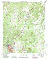
1971 Map of Russellville
USGS Topo · Published 1989About this map
The Southern railroad corridor and the Jackson Highway define the north-south axis of this North Alabama landscape, linking the growing city of Russellville with the smaller community of Littleville. The industrial character of the era is evident through numerous gravel pits, quarries, and extensive strip mines that mark the terrain between Bear Creek and Frazier Lake. Local history is preserved in a dense network of family and community landmarks, such as the Mountain Star Jr High School and several small cemeteries including Ramsey Cem and Tharp Cem. Residential expansion in the late 20th century is documented through subdivisions like Hester Heights and Woodlawn Heights, while the drive-in theater and golf course illustrate the social spaces of the mid-to-late century county seat.
Find a feature on this map
102 named features on this map. Tap any name to fly to it.
Don’t see what you’re looking for? This feature index may not catch every label — zoom into the map to look around manually.
Map Details
Editions of this 1971 Russellville Map
3 editions found
Other maps of this area

1924 · Tuscumbia
USGS Topo · 1:48,000

1925 · Barton
USGS Topo · 1:62,500

1926 · Tuscumbia
USGS Topo · 1:62,500

1926 · Barton
USGS Topo · 1:48,000

1929 · Barton
USGS Topo · 1:62,500

1936 · Russellville
USGS Topo · 1:24,000

1936 · Newburg
USGS Topo · 1:24,000

1936 · Frankfort
USGS Topo · 1:24,000

1936 · Isbell
USGS Topo · 1:24,000

1936 · Pride
USGS Topo · 1:24,000