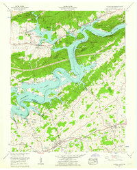
1961 Map of Russellville
USGS Topo · Published 1962About this map
Cherokee Lake dominates this East Tennessee landscape, formed by the damming of the Holston River and creating a complex shoreline that winds between Prophet Ridge and Nenny Ridge. This 1961 revision shows the area's transition into a recreational and residential hub, evidenced by the Lakemont Cabin Area and Fall Creek Dock. To the south, the agricultural valleys remain anchored by established settlements like Whitesburg and Russellville, where the Southern Railroad follows the natural corridor of the Lee Highway.
Find a feature on this map
73 named features on this map. Tap any name to fly to it.
Don’t see what you’re looking for? This feature index may not catch every label — zoom into the map to look around manually.
Map Details
Editions of this 1961 Russellville Map
3 editions found
Other maps of this area

1883 · Morristown
USGS Topo · 1:125,000

1893 · Morristown
USGS Topo · 1:125,000

1895 · Morristown
USGS Topo · 1:125,000

1935 · Rogersville
USGS Topo · 1:48,000

1935 · Tate Springs
USGS Topo · 1:48,000

1935 · Lee Valley
USGS Topo · 1:24,000

1935 · Springvale
USGS Topo · 1:24,000

1935 · Swan Island
USGS Topo · 1:24,000

1935 · Morristown
USGS Topo · 1:24,000

1935 · Russellville
USGS Topo · 1:24,000