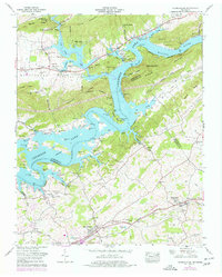
1961 Map of Russellville
USGS Topo · Published 1977About this map
Cherokee Lake dominates the center of this landscape, created by the impoundment of the Holston River and stretching into the valleys of Hawkins Co and Hamblen Co. The terrain is defined by parallel ridges like Short Mountain and Prophet Ridge, which channel the remaining free-flowing streams such as Poor Valley Creek and Bent Creek. The lower half of the map reveals the established infrastructure of the Southern Railway corridor, where the settlements of Russellville and Whitesburg are situated along the Johnson Andrew Highway.
Find a feature on this map
72 named features on this map. Tap any name to fly to it.
Don’t see what you’re looking for? This feature index may not catch every label — zoom into the map to look around manually.
Map Details
Editions of this 1961 Russellville Map
3 editions found
Other maps of this area

1883 · Morristown
USGS Topo · 1:125,000

1893 · Morristown
USGS Topo · 1:125,000

1895 · Morristown
USGS Topo · 1:125,000

1935 · Rogersville
USGS Topo · 1:48,000

1935 · Tate Springs
USGS Topo · 1:48,000

1935 · Lee Valley
USGS Topo · 1:24,000

1935 · Springvale
USGS Topo · 1:24,000

1935 · Swan Island
USGS Topo · 1:24,000

1935 · Morristown
USGS Topo · 1:24,000

1935 · Russellville
USGS Topo · 1:24,000