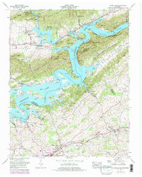
1961 Map of Russellville
USGS Topo · Published 1977About this map
The Holston River and the sprawling waters of Cherokee Lake dominate this East Tennessee landscape, weaving through a topography defined by ridges such as Prophet Ridge and the Red Knobs. This survey illustrates the rural character of the region during the early 1960s, with updates from the mid-1970s reflecting shifts in land use and woodland cover. The settlement patterns follow the valleys and ridges, with the historic community of Whitesburg and the town of Russellville situated along the Southern railroad line.
Find a feature on this map
65 named features on this map. Tap any name to fly to it.
Don’t see what you’re looking for? This feature index may not catch every label — zoom into the map to look around manually.
Map Details
Editions of this 1961 Russellville Map
3 editions found
Other maps of this area

1883 · Morristown
USGS Topo · 1:125,000

1893 · Morristown
USGS Topo · 1:125,000

1895 · Morristown
USGS Topo · 1:125,000

1935 · Rogersville
USGS Topo · 1:48,000

1935 · Tate Springs
USGS Topo · 1:48,000

1935 · Lee Valley
USGS Topo · 1:24,000

1935 · Springvale
USGS Topo · 1:24,000

1935 · Swan Island
USGS Topo · 1:24,000

1935 · Morristown
USGS Topo · 1:24,000

1935 · Russellville
USGS Topo · 1:24,000