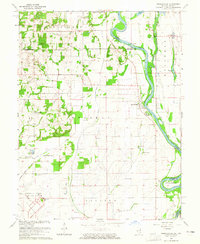
1964 Map of Russellville
USGS Topo · Published 1965About this map
The Wabash River serves as the winding border between Illinois and Indiana in this mid-century survey, dividing Lawrence and Crawford counties from Knox County. The landscape is defined by its drainage and aviation history, featuring the sprawling Lawrenceville Vincennes Municipal Airport in the south and the smaller Emison Airport to the east. The low-lying bottomlands are managed by an extensive network of waterways including Taylor Ditch, Allison Ditch, and Otter Pond Ditch, alongside a significant Levee system designed to protect the surrounding agricultural fields.
Find a feature on this map
38 named features on this map. Tap any name to fly to it.
Don’t see what you’re looking for? This feature index may not catch every label — zoom into the map to look around manually.
Map Details
Editions of this 1964 Russellville Map
2 editions found
Other maps of this area

1915 · Vincennes
USGS Topo · 1:62,500

1917 · Birds
USGS Topo · 1:62,500

1942 · Fritchton
USGS Topo · 1:24,000

1942 · Birds
USGS Topo · 1:62,500

1943 · Carlisle
USGS Topo · 1:24,000

1943 · Oaktown
USGS Topo · 1:24,000

1944 · Fritchton
USGS Topo · 1:24,000

1944 · Vincennes
USGS Topo · 1:62,500

1956 · Vincennes
USGS Topo · 1:250,000

1957 · Vincennes
USGS Topo · 1:250,000