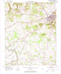
1952 Map of Russellville
USGS Topo · Published 1974About this map
Russellville serves as the focal point of this Logan County landscape, where the Louisville and Nashville railroad lines intersect at the heart of the community. In the early 1950s, the surrounding countryside remains deeply rooted in a network of small settlements and rural institutions. To the southwest, Ferguson and Lebanon are established along the winding path of Whippoorwill Creek, while dozens of country churches like Post Oak Ch and Whitaker Grove Ch act as local landmarks. The presence of the County Home Cem and the Williams Store crossroads suggests a self-contained agrarian economy. Significant terrain features, including Luckett Knob, punctuate the karst-like topography, which is also characterized by intermittent drainage features such as Dry Fork. This survey documents a transition period where traditional rural outposts like O'Roark and Cave Spring persist alongside modern developments such as the local Golf Course.
Find a feature on this map
28 named features on this map. Tap any name to fly to it.
Don’t see what you’re looking for? This feature index may not catch every label — zoom into the map to look around manually.
Map Details
Editions of this 1952 Russellville Map
3 editions found
Other maps of this area

1950 · Allensville
USGS Topo · 1:24,000

1950 · Olmstead
USGS Topo · 1:24,000

1951 · Olmstead
USGS Topo · 1:24,000

1951 · Adairville
USGS Topo · 1:24,000

1951 · Dot
USGS Topo · 1:24,000

1951 · Lewisburg
USGS Topo · 1:24,000

1951 · Homer
USGS Topo · 1:24,000

1952 · Russellville
USGS Topo · 1:24,000

1952 · Sharon Grove
USGS Topo · 1:24,000

1952 · Dennis
USGS Topo · 1:24,000