
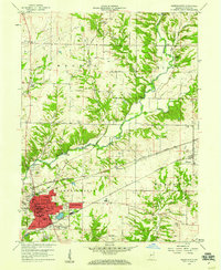
1955 Map of Russellville
USGS Topo · Published 1957About this map
Russellville serves as the primary hub in this mid-century portrait of northwestern Putnam County, where the Baltimore and Ohio railroad cuts across a landscape defined by the winding course of Raccoon Creek. The survey captures several small crossroads communities including Fincastle, Parkersburg, and Morton, reflecting the rural settlement patterns of the 1950s. The topography transitions from level agricultural fields in the north to the dissected creek valleys of the Russell and Clinton townships. Genealogists will find a high density of family and community burial grounds, such as Sutherlin Cem, La Follett Cem, and Pickle Cem, alongside local landmarks like Union Chapel and a Stone Quarry. An interesting marker of the era's social life is the Drive-in Theater located at the southern edge of the quadrangle in Monroe township.
Find a feature on this map
33 named features on this map. Tap any name to fly to it.
Don’t see what you’re looking for? This feature index may not catch every label — zoom into the map to look around manually.
Map Details
Editions of this 1955 Russellville Map
This is the sole edition of this map. No revisions or reprints were ever made.
Other maps of this area

1949 · Alamo
USGS Topo · 1:24,000

1951 · Clinton Falls
USGS Topo · 1:24,000

1951 · Mansfield
USGS Topo · 1:24,000

1953 · Indianapolis
USGS Topo · 1:250,000

1956 · Indianapolis
USGS Topo · 1:250,000

1956 · New Market
USGS Topo · 1:24,000

1957 · Indianapolis
USGS Topo · 1:250,000

1958 · Roachdale
USGS Topo · 1:24,000

1958 · Ladoga
USGS Topo · 1:24,000
1958 · Greencastle
USGS Topo · 1:24,000