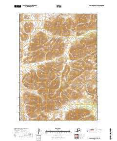
2019 Map of Russian Mission A-2 SW
USGS Topo · Published 2019About this map
Dominion Cr and Myrtle Cr cut through the interior of the Bethel Census Area in this 2019 survey of the Russian Mission A-2 SW quadrangle. The landscape is defined by its drainage systems, with Nippon Cr and Bear Cr flowing through the northern reaches of the township grid. While modern in its production, this U.S. Geological Survey map captures a vast, unpopulated terrain where the natural waterways are the primary landmarks. Researchers tracking local nomenclature or hydrography will find clear delineations of Discovery Cr, Sawpit Cr, and Fox Cr, providing a detailed record of the tributary network across townships T12N and T11N. The map focuses entirely on the relief and water features of this Alaskan interior region, offering a specific view of the land before any significant road development reached these coordinates.
Find a feature on this map
11 named features on this map. Tap any name to fly to it.
Don’t see what you’re looking for? This feature index may not catch every label — zoom into the map to look around manually.
Map Details
Editions of this 2019 Russian Mission A-2 SW Map
This is the sole edition of this map. No revisions or reprints were ever made.
Other maps of this area

1947 · Russian Mission
USGS Topo · 1:250,000

1950 · Russian Mission
USGS Topo · 1:250,000

1950 · Bethel
USGS Topo · 1:250,000

1954 · Russian Mission A-3
USGS Topo · 1:63,360

1954 · Bethel D-3
USGS Topo · 1:63,360

1979 · Bethel D-2
USGS Topo · 1:63,360

1979 · Russian Mission A-2
USGS Topo · 1:63,360

1980 · Russian Mission
USGS Topo · 1:250,000

1980 · Bethel
USGS Topo · 1:250,000
2019 · Bethel D-3 NE
USGS Topo · 1:25,000