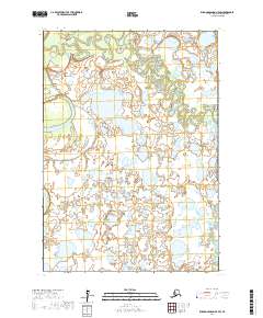
2017 Map of Russian Mission A-5 SW
USGS Topo · Published 2017About this map
Tuluksak River meanders across this landscape in the Bethel Census Area, defining a territory characterized by its intricate wetland systems and seasonal watercourses. The drainage patterns shown here are dominated by the winding path of the river in the north and the Fog River in the south, which serve as the primary geographical anchors for this remote stretch of the Alaska interior. The map illustrates the complex hydrography of the region, where oxbow lakes and smaller ponds dot the terrain between these two significant waterways. This 2017 digital survey provides an exact look at the natural boundaries within the Public Land Survey System, specifically marking the intersections of t12n r65w, t12n r64w, t11n r65w, and t11n r64w. The absence of man-made infrastructure or named settlements highlights the preserved state of this river-driven ecosystem.
Find a feature on this map
6 named features on this map. Tap any name to fly to it.
Don’t see what you’re looking for? This feature index may not catch every label — zoom into the map to look around manually.
Map Details
Editions of this 2017 Russian Mission A-5 SW Map
This is the sole edition of this map. No revisions or reprints were ever made.
Other maps of this area

1947 · Russian Mission
USGS Topo · 1:250,000

1950 · Russian Mission
USGS Topo · 1:250,000

1950 · Bethel
USGS Topo · 1:250,000

1954 · Russian Mission A-6
USGS Topo · 1:63,360

1954 · Russian Mission A-5
USGS Topo · 1:63,360

1954 · Bethel D-6
USGS Topo · 1:63,360

1954 · Bethel D-5
USGS Topo · 1:63,360

1980 · Russian Mission
USGS Topo · 1:250,000

1980 · Bethel
USGS Topo · 1:250,000
2017 · Russian Mission A-5 NW
USGS Topo · 1:25,000